
Marine
Exploring the Benefits of Hydrographic Surveying with Unmanned Surface Vehicles: A Guide to Choosing the Right USV
Hydrographic surveying is a vital tool in mapping and understanding our water bodies. It involves the measurement and mapping of bodies of water, including the depth, shape, and features of the seafloor. The use of unmanned surface vehicles (USVs) has revolutionized the field of hydrographic surveying, providing a safer, more efficient, and cost-effective way to collect data.
What are unmanned surface vehicles (USVs)?
Unmanned surface vehicles, or USVs, are watercraft that can operate on the surface of the water without a crew on board. They can be remotely controlled or operate autonomously using pre-programmed routes. USVs come in a variety of sizes and shapes, and they can be equipped with various sensors, including GPS, sonar, and cameras.
Benefits of using USVs in hydrographic surveying
-
Safety
Hydrographic surveying can be dangerous and physically demanding work, especially in rough weather conditions. The use of USVs eliminates the need for human operators to be on board the survey vessel, reducing the risk of accidents and injuries.
-
Efficiency
USVs are capable of collecting data at a much faster rate than traditional survey vessels, due to their smaller size, increased maneuverability, and ability to operate in shallow waters.
-
Cost-effectiveness
USVs are much cheaper to operate and maintain than traditional survey vessels, reducing the overall cost of hydrographic surveying projects. They also have a smaller carbon footprint, reducing the environmental impact of survey operations.
-
High-quality data
USVs are equipped with high-tech sensors and GPS technology, ensuring accurate and reliable data collection. They are also able to collect data in areas that may be inaccessible to traditional survey vessels.
Applications of USVs in hydrographic surveying
-
Environmental monitoring
USVs are used to monitor and collect data on water quality, temperature, salinity, and other environmental factors. This data is used to assess the health of the water body and identify potential threats to marine life.
-
Bathymetric surveys
USVs are used to collect data on the depth and shape of the seafloor, which is essential for safe navigation and understanding oceanic geology.
-
Search and rescue operations
USVs equipped with sonar sensors can be used to search for lost or stranded vessels, and to locate submerged objects.
-
Offshore energy exploration
USVs are used in offshore energy exploration to collect data on the seafloor, helping to identify potential sites for oil and gas exploration.
Challenges of using USVs in hydrographic surveying
While USVs offer many benefits, there are also some challenges to their use in hydrographic surveying. Some of these challenges include:
-
Weather conditions
USVs can be affected by weather conditions, such as high winds and waves, which can impact their ability to collect accurate data.
-
Navigation
USVs rely on GPS technology for navigation, and signal interference or inaccuracies can impact their ability to collect accurate data.
-
Data processing
The large amounts of data collected by USVs can be difficult to process and analyze, requiring specialized software and expertise.
How to choose the right USV for hydrographic surveying
When choosing a USV for hydrographic surveying, there are several factors to consider, including:
-
Size and maneuverability: The size and maneuverability of the USV will determine its ability to navigate shallow waters and confined spaces.
-
Sensors: The USV should be equipped with sensors that are appropriate for the type of surveying being conducted, such as bathymetric or environmental monitoring.
-
Autonomy: The level of autonomy required will depend on the specific surveying needs. Some USVs can be operated remotely, while others are fully autonomous.
-
Data processing: The USV should be compatible with the necessary software and data processing tools to ensure efficient and accurate data analysis.
-
Cost: The cost of the USV and associated equipment should be considered, along with the potential cost savings compared to traditional surveying methods.
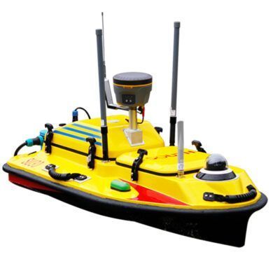
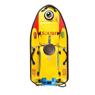
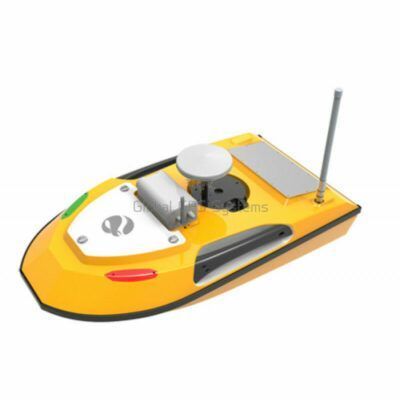
Popular unmanned surface vehicles
Marine
Click here to login or register
Marine
Click here to login or register
Conclusion
The use of USVs in hydrographic surveying is rapidly expanding, offering a safer, more efficient, and cost-effective way to collect data on our water bodies. When choosing a USV for hydrographic surveying, factors such as size and maneuverability, sensors, autonomy, data processing, and cost should be considered. Examples of USVs currently being used for hydrographic surveying include the Saildrone Surveyor, SeaRobotics SR-1, and OceanAlpha E40. As technology continues to advance, the use of USVs in hydrographic surveying is expected to become even more widespread, leading to improved understanding and management of our marine environments.